Showing posts with label Earth. Show all posts
Showing posts with label Earth. Show all posts


Amur Leopard Cub
Thursday, September 1, 2011 0 comments These guys are about as close to extinction as you can get. There are only 35-40 known wild Amur Leopards in existence. They are big cats that live on the Russian-Chinese border near the Sea of Japan. For more information, click here.
Mammatus Clouds Above North Carolina
Monday, August 29, 2011 0 comments This is a photograph of Mammatus clouds over North Carolina from Rich Bruner on Earth Science Picture of the Day. According to the accompanying article,
The orange color of the clouds is attributed to a low Sun. Sunlight has been attenuated by the greater path-length that occurs when the Sun lies near or below the horizon. Here, the Sun has already set (at the surface), but the lofty clouds are still exposed to the Sun's lingering rays.

Fuzzies Back At the Beach
Thursday, August 25, 2011 0 comments
Les and Fuzzy are back down at Seagrove Beach, Florida, for the week, which they deserve. Poor Fraz spent most of our family vacation there earlier this summer in the hospital, and Leslie spent most of her time on the telephone keeping kinfolk back home apprised of the situation. I talked to Les yesterday, and they were enjoying the beautiful weather down there. Hurricane Irene is menacing the Bahamas and the Eastern seaboard, but when a hurricane forms down there it sucks up all of the clouds, energy and moisture, leaving the weather nice elsewhere.
Earthquake Damage Closes Washington Monument
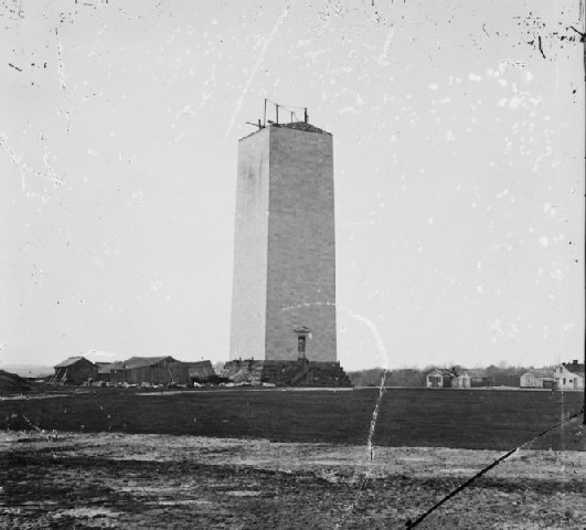
0 comments The above photo from the National Park Service shows a crack at the top of the Washington Monument on the National Mall in Washington, DC, that was caused by this week's earthquake in Virginia. The below photo shows the Washington Monument as it existed during the War Between the States, its construction being halted by the exigencies of war. My Aunt Joan felt the earthquake, and told Mom that it was a frightening experience. Here in Maryville, Sherry felt her chair rocking back and forth at the hospital. I was here in town, too, and didn't feel a thing.
Satellite Image of the Smokies
Tuesday, August 23, 2011 0 comments This is an image from Landsat 7. According to NASA's Earth Observatory website,
This Landsat scene shows the park, with its southern boundary along Lake Fontana. The central high ridgeline through the spine of the park is evident, with the light green forests of the lower lands and slopes giving way to the darker green regions of the ridges and peaks. The lower region forests are dominated by deciduous leafy trees (which strongly reflect near-infrared radiation, which is colored green in this image). At higher altitudes, deciduous forests give way to coniferous trees like Fraser Firs, which are less dramatically reflective at near-infrared wavelengths, and so appear darker in the scene.
Subscribe to:
Posts (Atom)

 Posts
Posts